The redlined neighborhood I grew up in
I was curious if the neighborhoods where I got mugged, beat up, and learned to be a white boy meant being targeted for violence with impunity growing up were officially redlined. I didn’t know where to find maps. They could be from insurance companies, government agencies, and who knows what other sources.
I finally found one, though from 1937, decades before I was born and with a world war in between. It’s from an insurance company. Here’s all of Philadelphia. You can tell how much was rated differently by color.
I grew up in three homes in northwest Philadelphia. I’ll zoom in below.
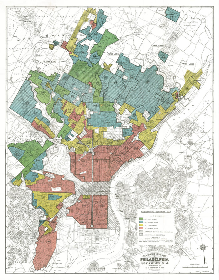
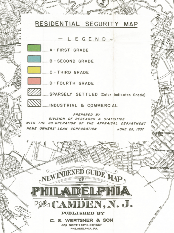
Zooming in on the legend, we see red is redlined, the lowest grade. It also shows it was made for the Home Owners’ Loan Corporation so it probably implied what regions could receive loans and at what rate, or not.
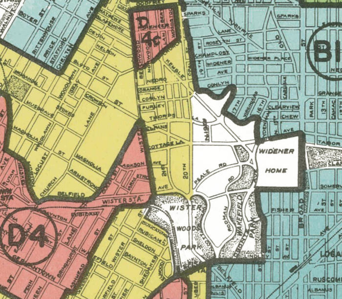
Here is the part where my three homes were. Keep in mind that redlining increased after WWII, so the red zones probably increased by my birth.
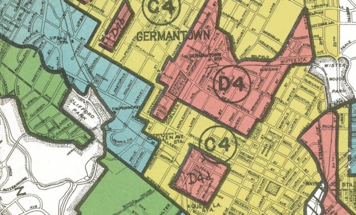
My dad’s home was in the green part on the left, just below the white (undeveloped) part that says “Clifford Park,” which happens to be where the sledding hill I talked about in my third TEDx talk, which began saying that I grew up near the best sledding hill in the world. I suspect that region remained green or at worst blue by my childhood.
My mom’s home on Rockland Street is on the bottom right, just on the yellow side of the red triangular shaped region. I am confident that the red area increased to include her house by when we lived there.
Her next home was in the yellow zone just south of the “GER” in Germantown, on Walnut Lane just south of McCallum Street. Ironically, the time I got mugged for my watch was in the blue zone on Walnut Lane a block south of her house. The first time I got mugged for a bike was in the red/yellow border due south of the M in Germantown.
My junior high school, where I was one of two white boys in a class of 24 was in the south edge of the red zone roughly south of the 15. When my friend (the other white boy in the class) got mugged with me, we were walking west in that red zone toward the subway, which ran under Broad Street, the white hatched zone between the two red zones.
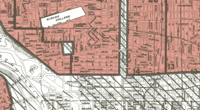
My high school was in the undeveloped white zone west of where it says “Widener Home” in the map below. It must not have moved to its current location yet in 1937 since some of the streets in this map don’t exist any more. I was punched in the face once waiting for the SEPTA bus to go home after school one day. I’m confident that area got redlined by when I went there, or at least yellow.
I’ll keep looking for more maps more recent than 1937.
Read my weekly newsletter

On initiative, leadership, the environment, and burpees